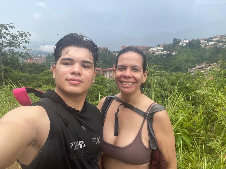
Subiendo "El Volcan" con mi Tía [ESP | ENG]
 |
|---|
Hola amigos de Hive y de #SWC, el día de ayer domingo, tuve la oportunidad de irme de senderismo con mi tia, pero esta vez no al Ávila, sino a el cerro “El Volcan”
El pico más alto del Municipio Baruta, uno de los que conforma el área metropolitana de la ciudad de Caracas. Alcanza una elevación de 1490 metros sobre el nivel del mar, y a pesar de su nombre, realmente el lugar no tiene un registro de actividad volcánica. presenta un paisaje de montaña con muchos arboles y pinos, con un relieve de topografía accidentada en la cual los valles son estrechos con estribaciones que originan una serie de lomas. En toda su área que ocupa existen caminos que conducen a sus distintas laderas y, una de estas, es una suerte de mirador que ofrece una gran vista de Caracas. Algunas antenas de telecomunicaciones, de radio y televisión han sido instaladas en el tope del lugar para prestar servicio a la ciudad de Caracas. Lamentablemente, no pudimos tener la dicha de visitar estos lugares ya que, a un poco más de la mitad del camino, comenzó a llover bastante, y este cerro, a diferencia del Ávila, es mucho mas resbaladizo por las hojas y mucho mas cuando la tierra esta mojada. A pesar de que no pudimos llegar hasta arriba, fue un momento y una experiencia totalmente grata y agradable. Un lugar que sin ninguna duda me gustaría poder regresar, y esta vez completarlo hasta el final.
Hello friends of Hive and #SWC, yesterday Sunday, I had the opportunity to go hiking with my aunt, but this time not to the Avila, but to the hill “El Volcan”.
The highest peak of the Baruta Municipality, one of those that make up the metropolitan area of the city of Caracas. It reaches an elevation of 1490 meters above sea level, and despite its name, actually the place has no record of volcanic activity. It presents a mountain landscape with many trees and pines, with a relief of rugged topography in which the valleys are narrow with foothills that originate a series of hills. In all its area there are roads that lead to its different slopes and, one of these, is a sort of viewpoint that offers a great view of Caracas. Some telecommunications, radio and television antennas have been installed on top of the place to provide service to the city of Caracas. Unfortunately, we could not have the pleasure of visiting these places because, a little more than half way up, it started to rain a lot, and this hill, unlike the Avila, is much more slippery because of the leaves and even more so when the ground is wet. Although we could not get to the top, it was a very pleasant and enjoyable experience. A place that without any doubt I would like to return, and this time to complete it to the end.
INSTAGRAM |
|---|
 |
▶️ 3Speak
0
0
0.000
Buen senderismo bro 🤩👍🏻
Uff, que grandioso es ir a esos lugares se respira un aire bastante fresco y se disfruta de una buena vista. Que bueno que hayas disfrutado con tu tía esa gran experiencia 😁.